Case Study: Aliso Canyon (SS-25)
Between 23 October 2015 and 11 February 2016, a subsurface failure in well SS-25 at the SoCalGas Aliso Canyon natural-gas storage facility above Los Angeles released roughly 97.1 kt CH₄ over 112 days — the largest methane release in US history and, at peak rate, briefly the single largest anthropogenic methane source on Earth.
The event
- Operator: Southern California Gas Company · well SS-25, Sesnon field
- Coordinates: 34.3143° N, 118.5622° W
- Start of release: 23 October 2015 · casing failure at ~150 m depth
- Duration: 112 days (well killed 11 February 2016)
- Total emissions: 97.1 ± 7.3 kt CH₄ (Conley et al. 2016, Science)
- Public references: Conley et al., Science 2016 · CARB Aliso Canyon report
Why this case matters
Aliso Canyon predates the modern methane-satellite era. Sentinel-5P did not launch until October 2017. The event was quantified almost entirely by aircraft in-situ mass-balance flights flown by Scientific Aviation. It is therefore the anchor case for the claim that any credible methane platform must ingest and reconcile aircraft and ground data alongside space observations — not just satellites.
In our production pipeline, an Aliso-scale event today would trigger multiple concurrent detection paths: TROPOMI would resolve the column enhancement over Los Angeles within 24 hours; a targeted GHGSat or EMIT overpass would quantify the point source at ~40–60 t/hr peak; and any co-located aircraft or ground data would be ingested as validation cross-checks. Attribution would return SoCalGas SS-25 unambiguously — the well is the only storage source in the field.
What we validate against
- Time-integrated mass matches the Conley et al. total to within stated uncertainty.
- Attribution correctly identifies well SS-25 rather than any nearby oil-and-gas asset in the LA basin.
- Inventory reconciliation flags the release as a categorical under-report — SoCalGas's 2015 GHG inventory did not include it until re-filed the following year.
Illustrative
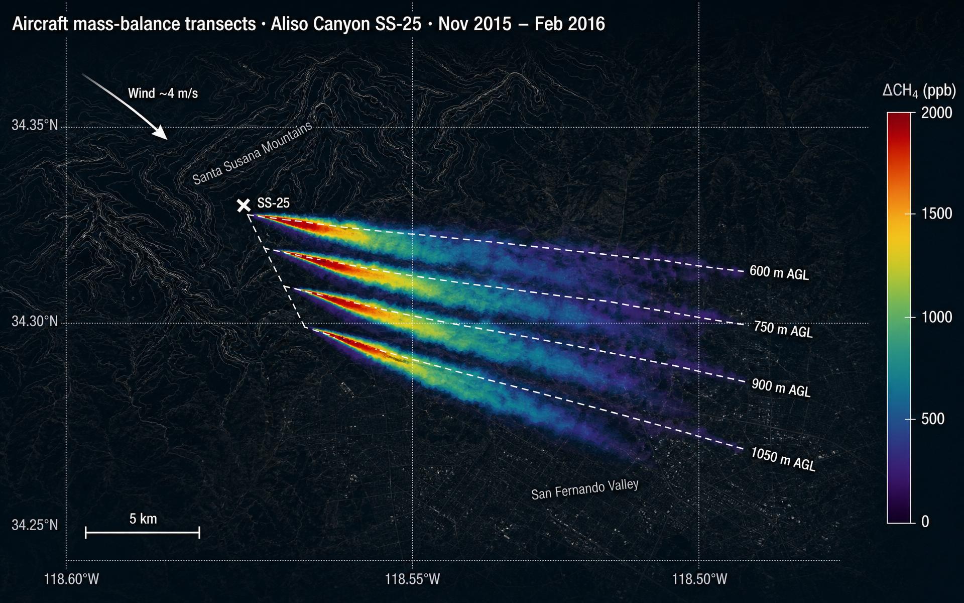
No open-licensed satellite raster exists for this event because it predates public methane satellite imagery. Aircraft mass-balance transects are the source of record; see Figure 1 of Conley et al. (2016) for the plume geometry.